

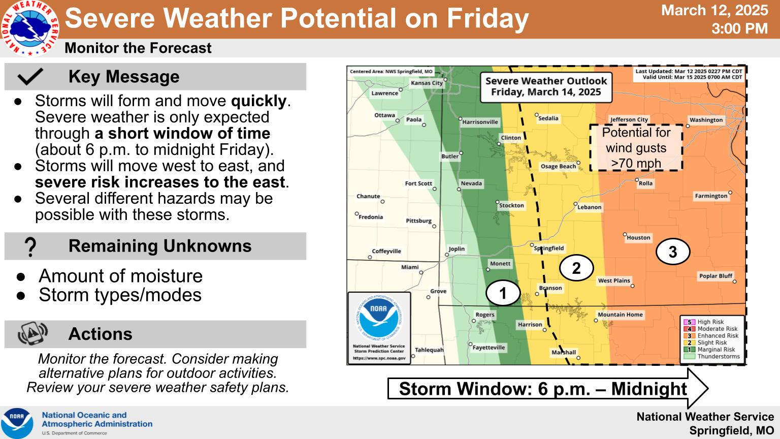
While officially still in winter for another week, the Lakes Region will see an active spring-like weather pattern on Friday.
The latest information from the National Weather Service indicates that a slight risk of sever thunderstorms as possible through the Highway 65 corridor with a slightly less risk west of a Cassville to Berryville line. Areas east of the Lakes Region have a stronger chance of severe thunderstorms. Storms are expected to develop during the afternoon Friday with the strongest chance for severe storms being early Friday evening.
Due to the current track of the front, storms may produce limited rainfall with most forecasts indicating a 40-50% chance of rain Friday.
The entire region is expected to see high winds ahead of the front with potential gusts Friday higher than 45 MPH possible. Some forecast models indicate the potential of 50-60 MPH gusts in areas east of a Branson-Harrison line. Many area agencies have continued to urge against outdoor burning with the current conditions and two areas in Arkansas, Boone County and the community of Bull Shoals in Marion County, have burn bans in place.
The National Weather Service has issued a combination of Wind Advisories, High Wind Advisories, Red Flag Warnings, and Fire Weather Watches for the region Friday.


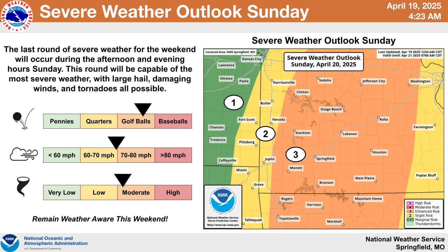 Rainy Saturday, Stormy Easter Sunday
 Lakes Region Visitor Has First Confirmed Case of Measles in Missouri
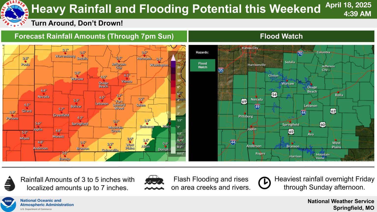 Easter Weekend Rainy and Stormy
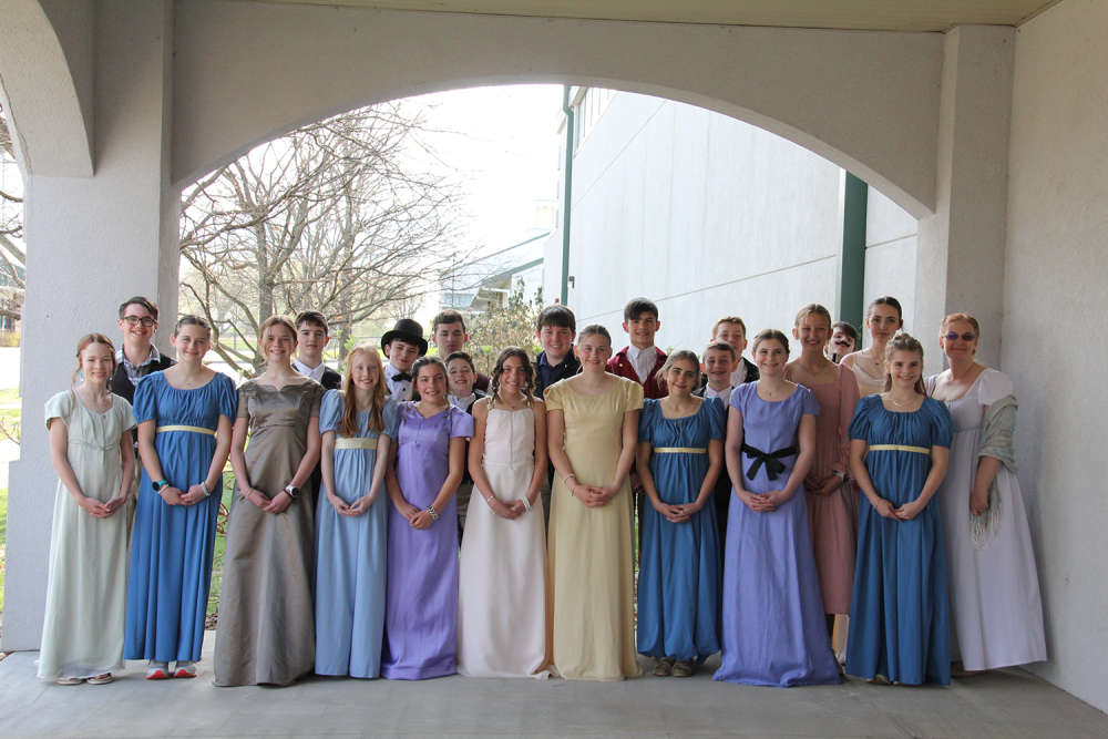 School of the Ozarks hosts Regency Day for seventh grade students