

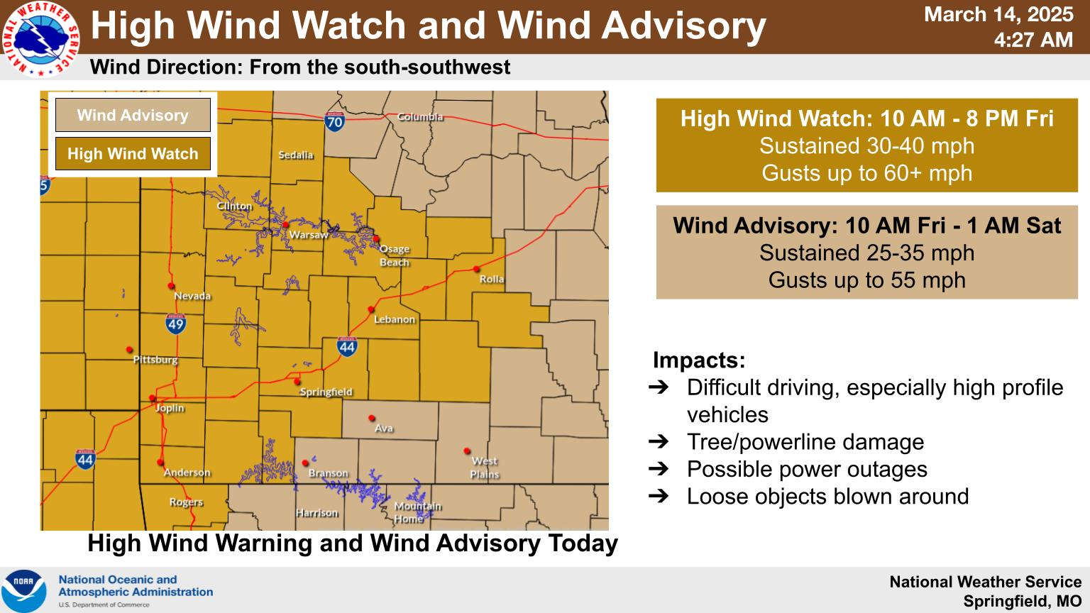
While there is a chance some in the Lakes Region will see severe thunderstorms, the biggest threat today will be the wind.
The National Weather Service has issued several advisories regarding potential wind speed and gusts. The Table Rock Region in Barry and Stone Counties are part of a High Wind Warning with wind gusts approaching 60 MPH possible this afternoon while the rest of the Lakes Region is under a Wind Advisory with gusts possible from 50-55 MPH.
The entire region is under a Red Flag Warning today with outside burning not recommended with the high winds, warm temperatures, and low relative humidity leading to the potential of any fire quickly getting out of control.
As a front gets closer later this afternoon, the potential for pop-up severe thunderstorms exists. However, conditions will just be beginning to lead to storm development as the front moves through Lakes Region so storms will be isolated and many areas are not expected to see storms or rain at all, but areas that do see storm development could see the potential for tornado development as well as hail and wind gusts approaching hurricane levels of 75 MPH or higher. The severe chances increase east of the Lakes Region in south central and southeast Missouri as well as north central and northeast Arkansas.


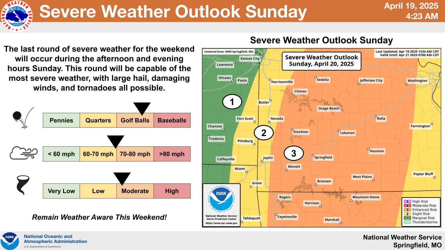 Rainy Saturday, Stormy Easter Sunday
 Lakes Region Visitor Has First Confirmed Case of Measles in Missouri
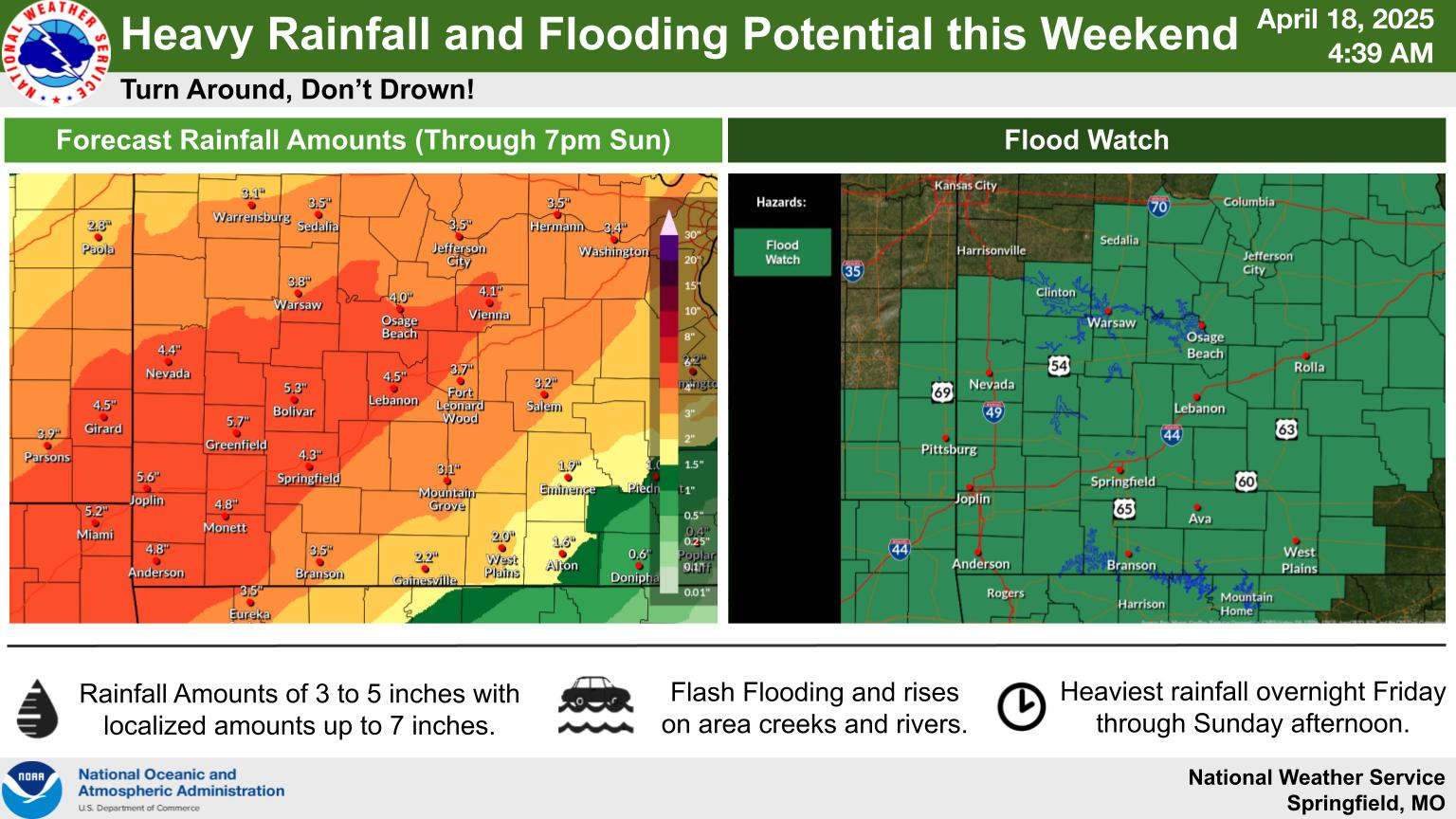 Easter Weekend Rainy and Stormy
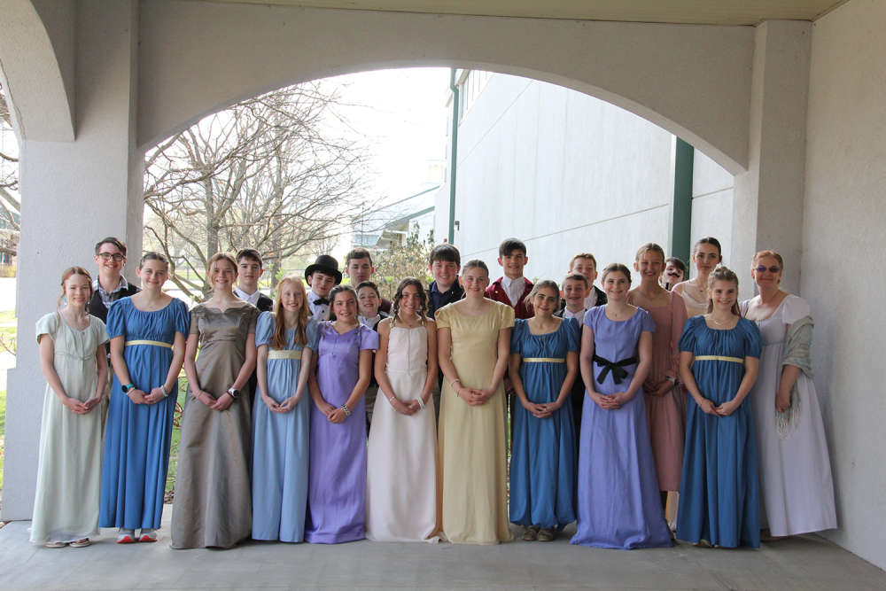 School of the Ozarks hosts Regency Day for seventh grade students