

An update of expected weather with Round One this evening.
12:30
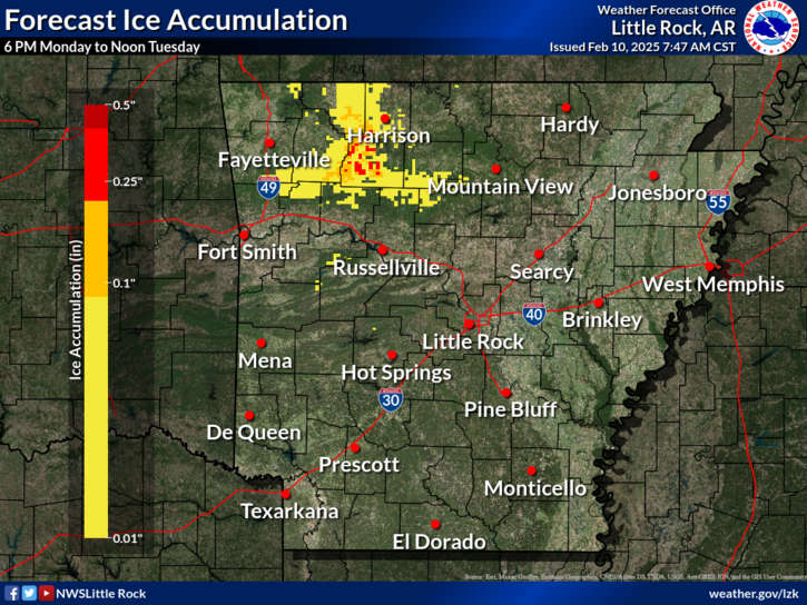
The National Weather Service in Little Rock has issued a Winter Weather Advisory for Higher Elevations of Boone, Newton, and Searcy Counties for this evening and mid-morning Tuesday. Forecasters say freezing rain is expected in the advisory area which includes areas southwest of Harrison as well as most of Newton and areas of Searcy County including around Marshall.
In addition, forecasters with the NWS Office in Springfield have increased the chances of some brief periods of sleet and freezing rain as precipitation moves through early Tuesday morning. Forecasters still expect little to any ice accumulation with the first wave.
The second wave of precipitation still has the greater potential for a mixture of winter precipitation with more information with the original story below:
The first wave of two systems of winter weather is expected to move across the Lakes Region tonight and Tuesday.
According to forecast projections by the National Weather Service and other media meteorologist, the first system looks to have little impact on the region. Rain will begin this evening and continue through the day on Tuesday. There is a chance of some sleet mixing in at times, primarily on the Missouri side of the boarder, before the rain ends Tuesday afternoon.
After a break Tuesday evening, rain redevelops early Wednesday but will quickly mix with freezing rain before sunrise. The wintry mix will continue with through the day with possible travel impacts due to glazing of area roads.
Precipitation will end Wednesday night, but very cold temperatures are expected Thursday with highs only around the freezing mark with lows in the teens.


 Local Pantry to Answer Questions about USDA Funding Cuts
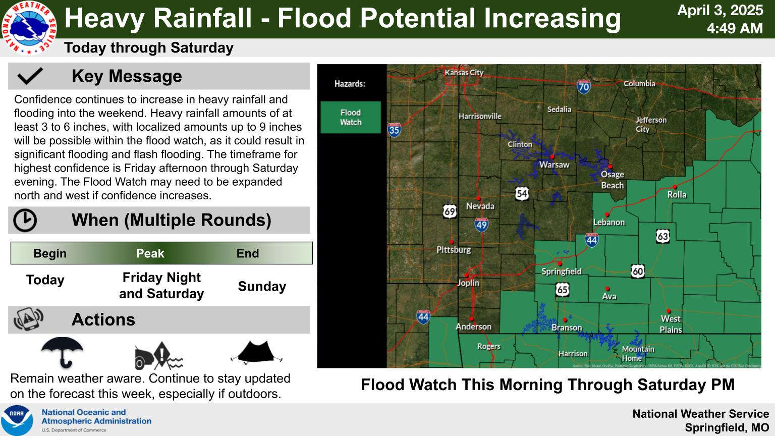
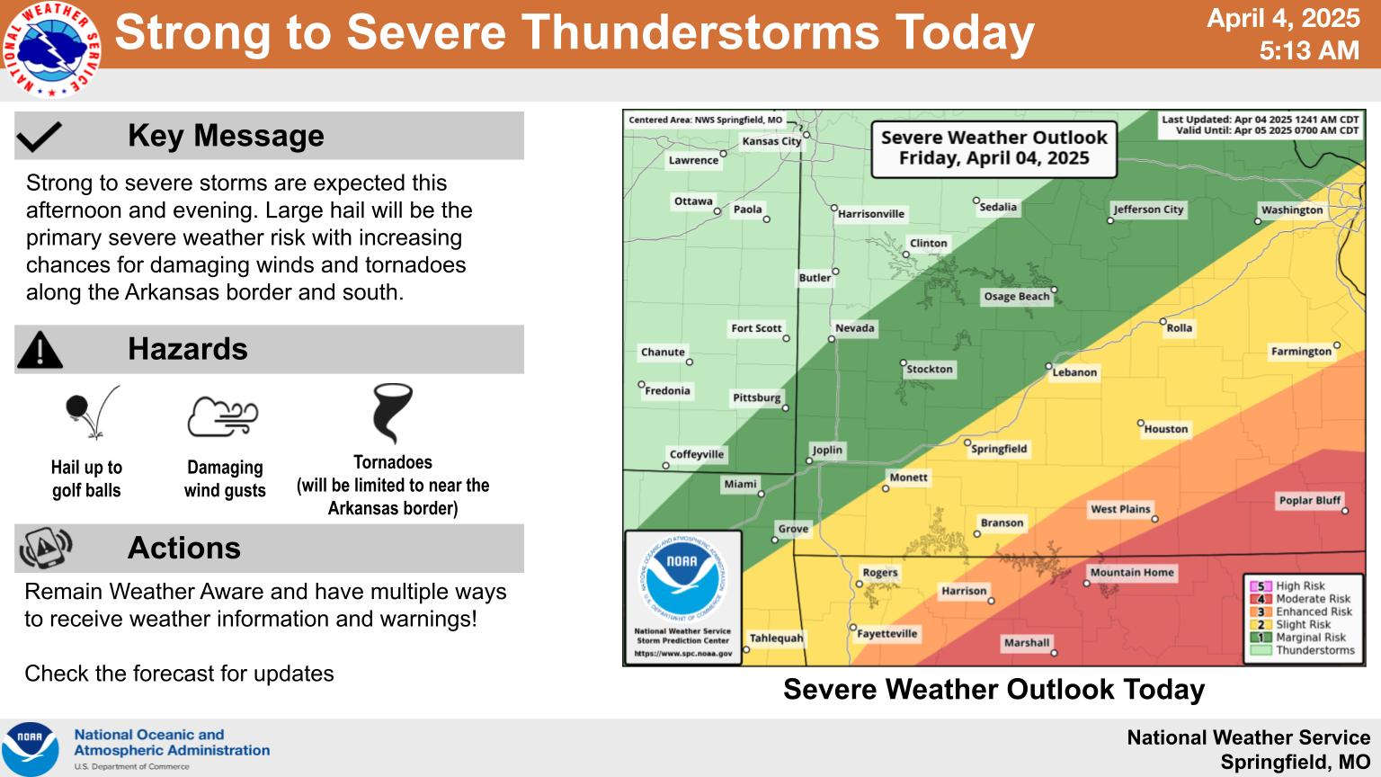 Heavy Rain, Severe Weather Update
 Schools Impacted By Storms
 Wednesday Storms, Thursday Rain
 Eureka Springs Police Officers Save Lives in Fire