

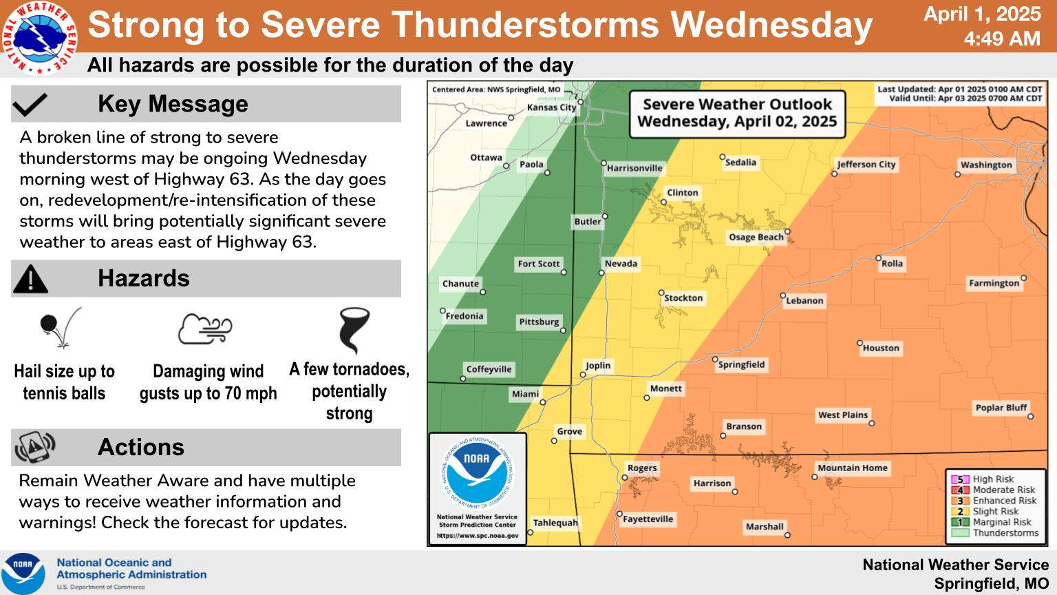
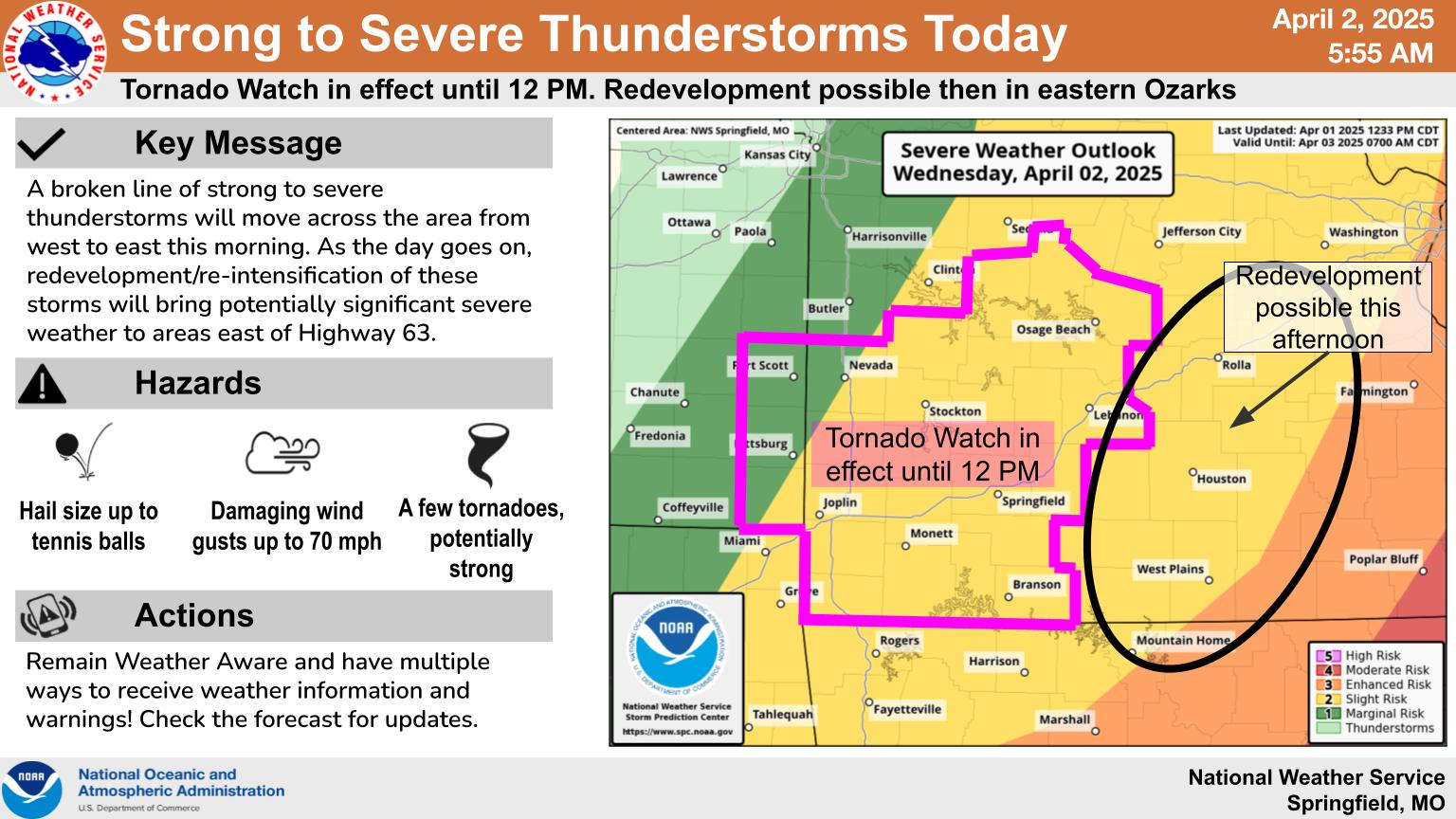
National Weather Service forecasters continue to monitor the potential for severe thunderstorms over the next few days plus a chance of heavier rain going into the weekend.
After a dry and windy day, overnight will see a chance of thunderstorms develop with a marginal risk of severe weather. That risk becomes elevated on Wednesday as storms are expected to move through during the morning into early afternoon with all modes of severe weather possible, including some tornados.
Significant rain is possible late in the week. Meteorologist Eric Wise with the National Weather Service in Springfield says during an interview on KRZK’s “Ozarks Now” program that the front moving through the region Wednesday will push back to the north and stall over northern Arkansas Friday. Several bands of heavy rain are possible Friday and Saturday with Wise saying that while the heaviest rain is expected in southeast Missouri and northeast Arkansas, some of those bands could rotate through parts of the Lakes Region.
The complete interview with Eric Wise is below:


 Active Weather for the Week, Weekend
 Sides Pleads Not Guilty in Taney County Case
 College of the Ozarks students experience new Global War on Terrorism Tour
 Downtown Branson Construction Set to Begin This Week