

After days of stormy and rainy weather, winter conditions revisit the Lakes Region for a day.
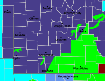
National Weather Service forecasters predict that as precipitation ends this morning, some snow will develop. While most of the Lakes Region will see little impact, some areas of Barry and Stone Counties can expect some Winter Driving Conditions as will areas around Springfield. The entire region is expecting at least some snow fall but little accumulation is expected.
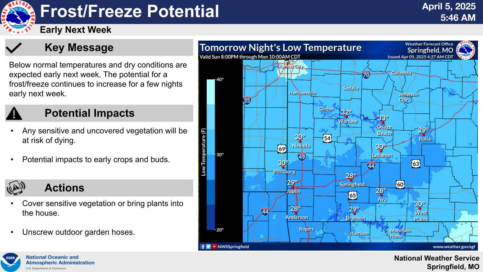
Highs today will only be in the 40s today with low temperatures tonight expected at 30 degrees or lower. Southwest Missouri is under a Freeze Warning for tonight and Monday morning while northern Arkansas has combined Freeze Watches and Frost Advisories in effect. Officials remind people that sensitive and uncovered vegetation will be at risk of dying and could also impact early buds and crops.
Temperatures will warm to the 60s on Monday but another chance of frost will take place Monday night into Tuesday. Conditions will warm up during the week with temperatures back in the 70s by Wednesday.
While it feels like winter, lingering effects of storms over the last few days continue with several roadways continuing to have water over them with many creeks or streams cresting around their maximum level over the next two days.
That includes the James River at Galena that will crest at 15 Feet later today, which is at Flood Stage. Other areas of the James around Boaz will crest around 12 Feet, two feet above Flood Stage this morning. Areas east of Branson remains in Flood Warnings today as does the James River.
Meanwhile, most of the Buffalo National River remains at Flood Stage but has crested and is beginning to drop.


 Municipal Election Day Tuesday
 Weekend Weather: Last Round of Storms, Possible Snow, Frost
 Four People Seriously Injured in Earl Morning Crash
 Local Pantry to Answer Questions about USDA Funding Cuts
 College of the Ozarks hosts Spring 2025 Career Expo