

A brief period of winter precipitation ahead of a major winter storm predicted to impact the Lakes Region on Tuesday.
After temperatures were into the 40s and 50s this afternoon with rain, another band of precipitation will move through as temperatures drop back into the 20s with rain to be possibly mixed with snow and sleet. Up to an inch of accumulation is possible and few slick spots on area roads possible Sunday morning.
A brief warm-up will take place on Monday ahead a the major winter storm expected for Tuesday.
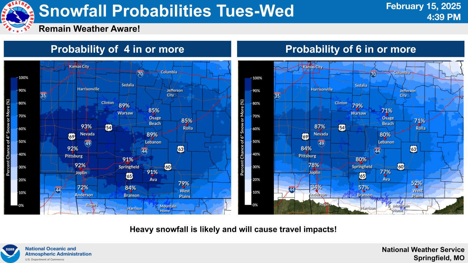
The National Weather Service has already issued a Winter Storm Watch for the Missouri Ozarks for Tuesday into Wednesday Morning with current projections calling for a possible 4-6 inch snowfall. A watch or advisory is yet to be issued for northern Arkansas, but forecast projections say at least 2-4 inches of snow with localized heavier amounts are possible. The snow will be accompanied by strong and gusty winds which could create blizzard conditions during the day. Widespread travel impacts are expected.
With the new system will also come arctic air which will see temperatures plummet with highs only in the teens to around 20 Wednesday and Thursday with overnight lows at or below zero.
More updates will be posted as weather forecasters refine the predictions for the storm on Tuesday.


 Local Pantry to Answer Questions about USDA Funding Cuts
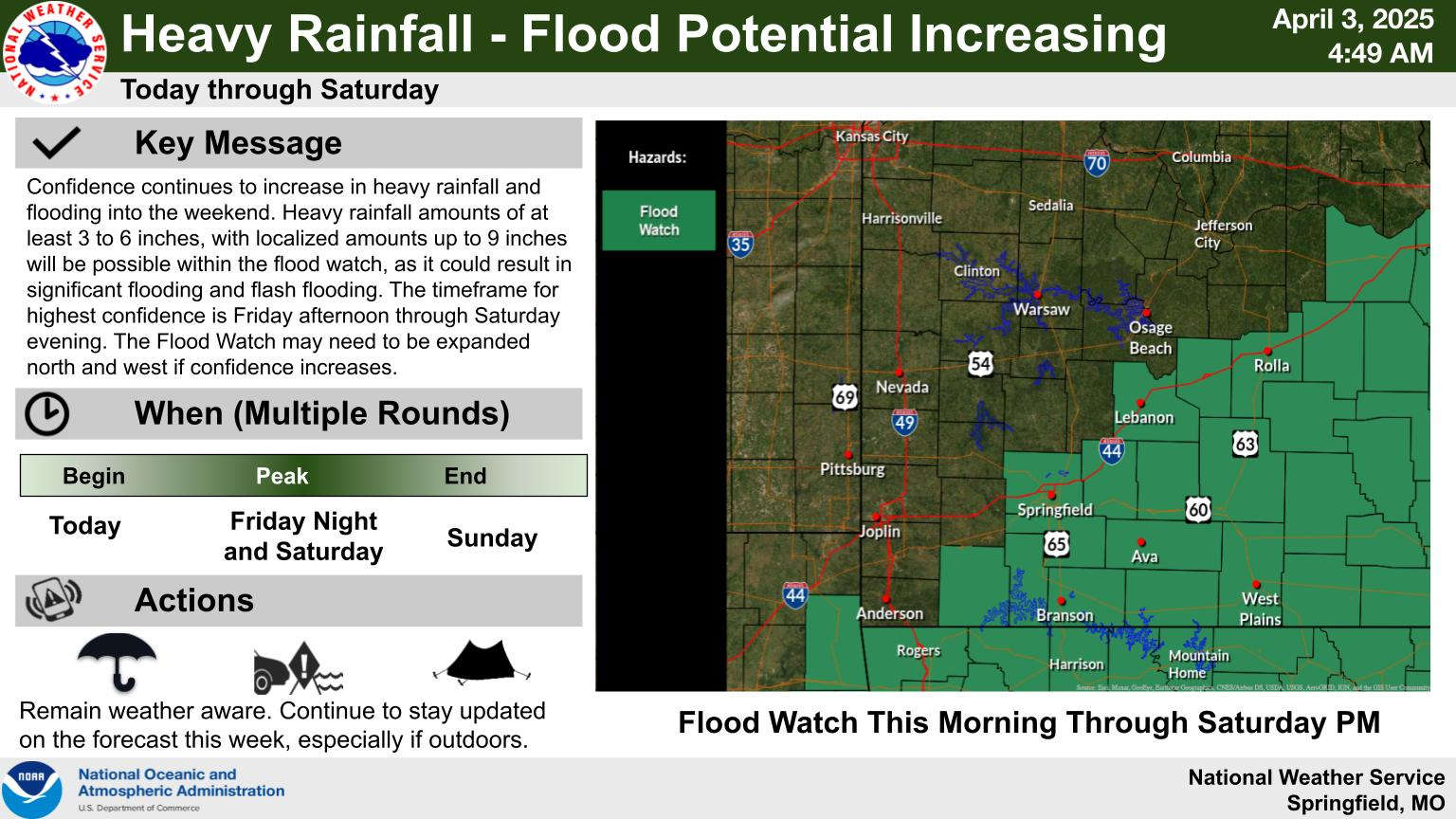
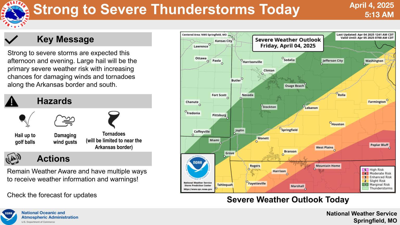 Heavy Rain, Severe Weather Update
 Schools Impacted By Storms
 Wednesday Storms, Thursday Rain
 Eureka Springs Police Officers Save Lives in Fire