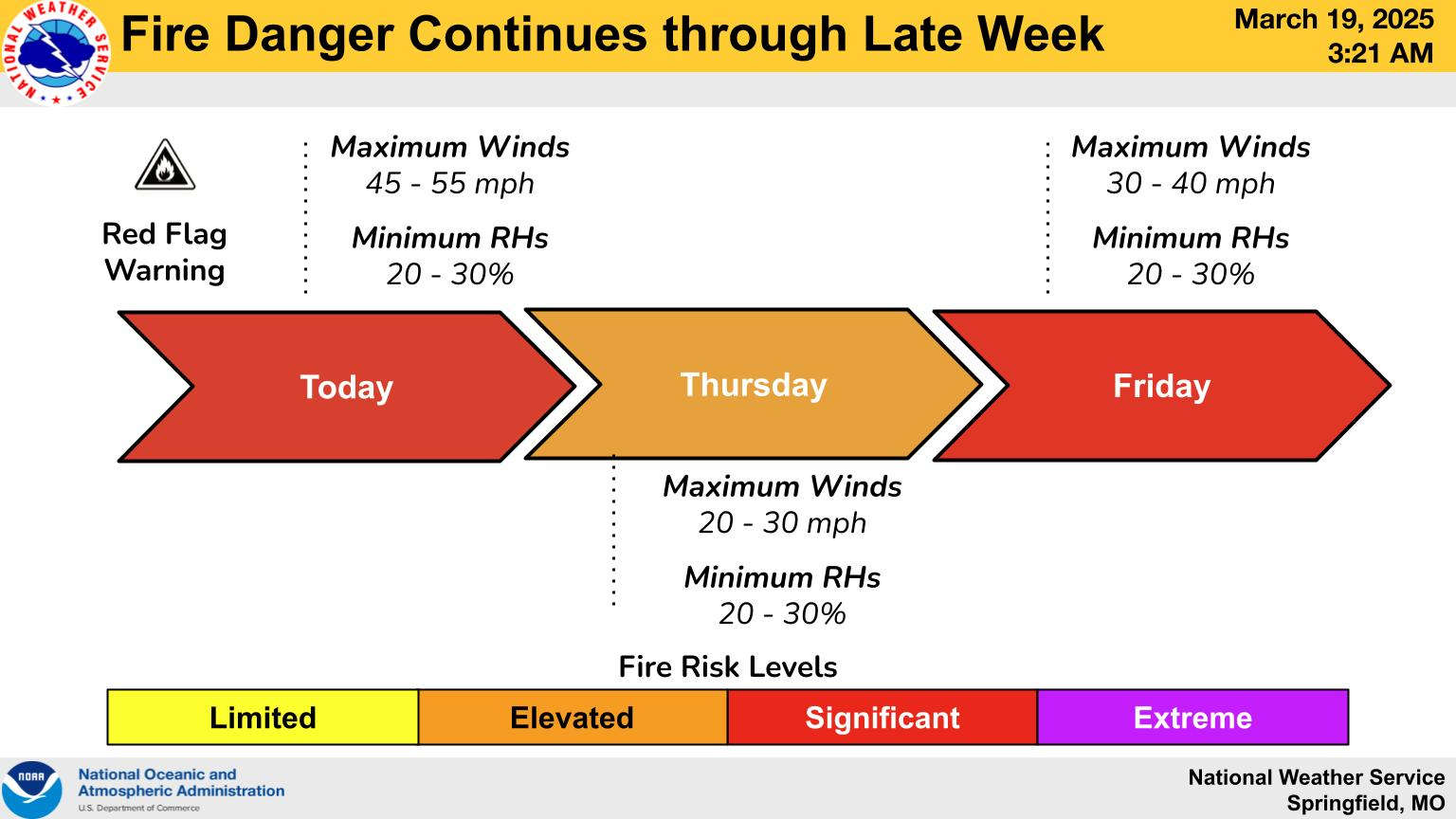
The last full day of winter will see a wild swing in temperatures, very strong and gusty winds, and maybe even a little winter precipitation.
A front moves through the Lakes Region today and while temperatures are starting in the 60s this morning, they will begin to drop early this afternoon falling into the 30s by this evening. Wind gusts could approach 45-50 MPH this afternoon as the front makes its was through the area.
As the front moves through, some rain will develop. No severe weather is expected however the rain could change over to snow showers before ending overnight. Little to no accumulation is expected.
Thursday will be dry and cooler with lows in the 30s and highs only in the 50s.
The windy conditions are expected to persist the rest of the week keeping the fire risk elevated. The entire area is under a Wind Advisory today and most the area also under a Red Flag Warning with outdoor burning still not recommended.


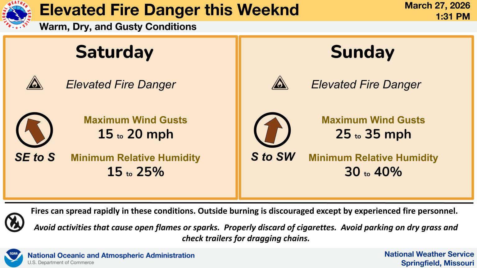 Cold Start to Weekend, Fire Hazard Remains
 Stone County Ambulance District Continues Growth
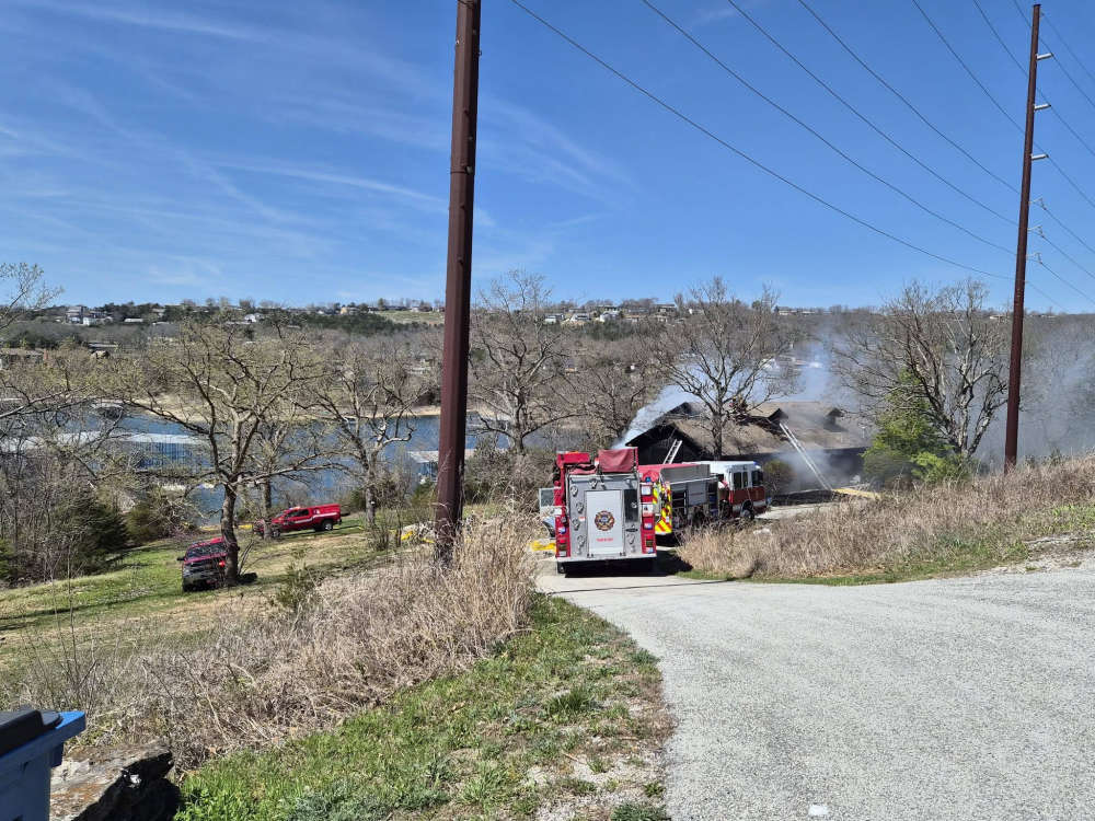 Fire, Traffic Crash in Kimberling City
 Retirement Ceremony for Ted Martin Next Week
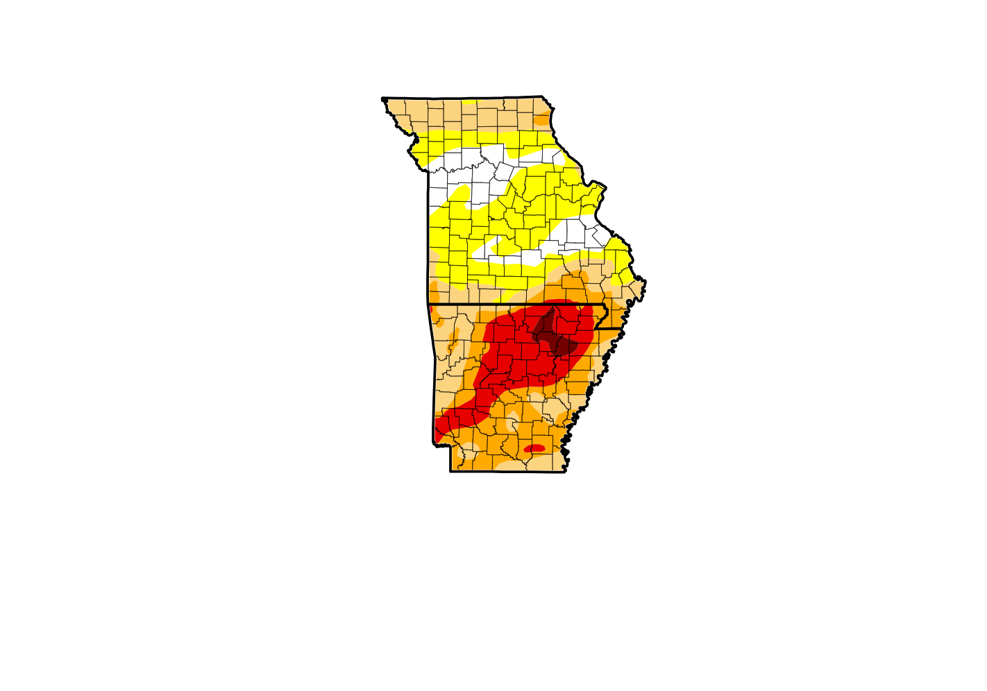 Drought Slowed, But Remains in Lakes Region