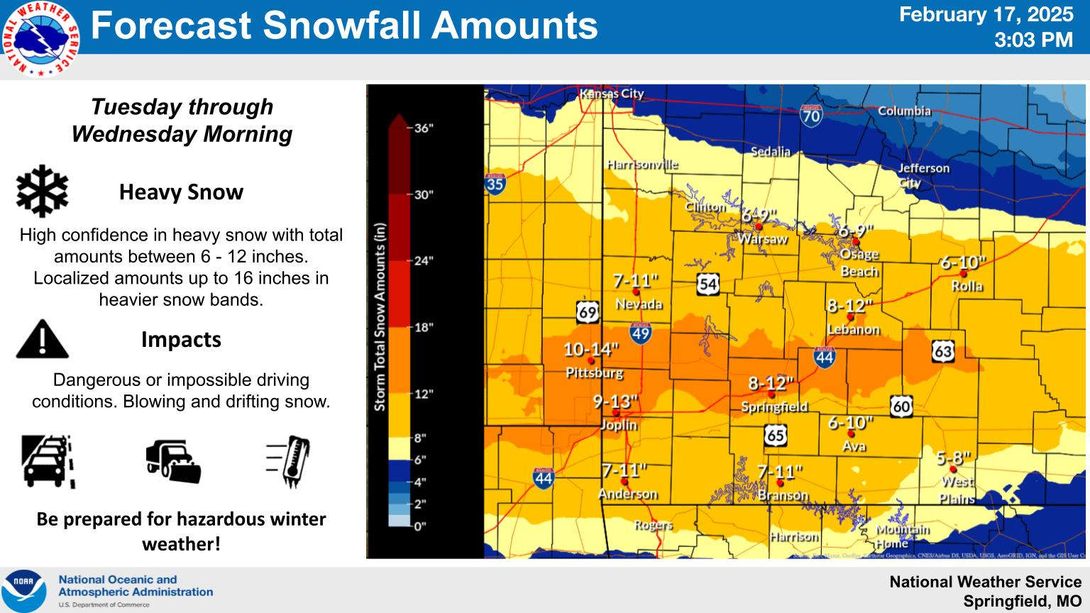
National Weather Service forecasters have now issued Winter Storm Warnings for the entire Lakes Region for Tuesday.
UPDATE
The latest information from the National Weather Service indicates a slightly higher predicted snowfall. For the Missouri Lakes Region including the Branson Area, a potential 7-11 inch snowfall is expected while amounts in northern Arkansas including the Harrison area predicted to be 6-8 inches.
Original Story
On Sunday, the National Weather Service in Springfield had upgraded to a Winter Storm Warning for the upcoming storm and this morning, the NWS Offices in Little Rock and Tulsa followed suit which brings the entire Lakes Region into the warning zone.
The warning now has all of the northern Arkansas Lakes Region Counties of Boone, Carroll, Madison, Marion, Newton, and Searcy in the warning area as are the southern Missouri counties of Barry, Christian, Ozark, Stone, and Taney. The Warning in Missouri also covers the Springfield area and extends into central Missouri.
Snow fall amounts have been adjusted slightly with the Branson area now projected to get between six to nine inches of snow with northern Arkansas looking at around a four to seven inch total.
Snow is expected to arrive Tuesday morning but not expected to become heavy until the afternoon.
Cold Weather Advisories have been issued for much of the region starting Tuesday and going through Thursday with high temperatures in the teens, lows at or below zero and and wind chills below zero through the rest of the week.
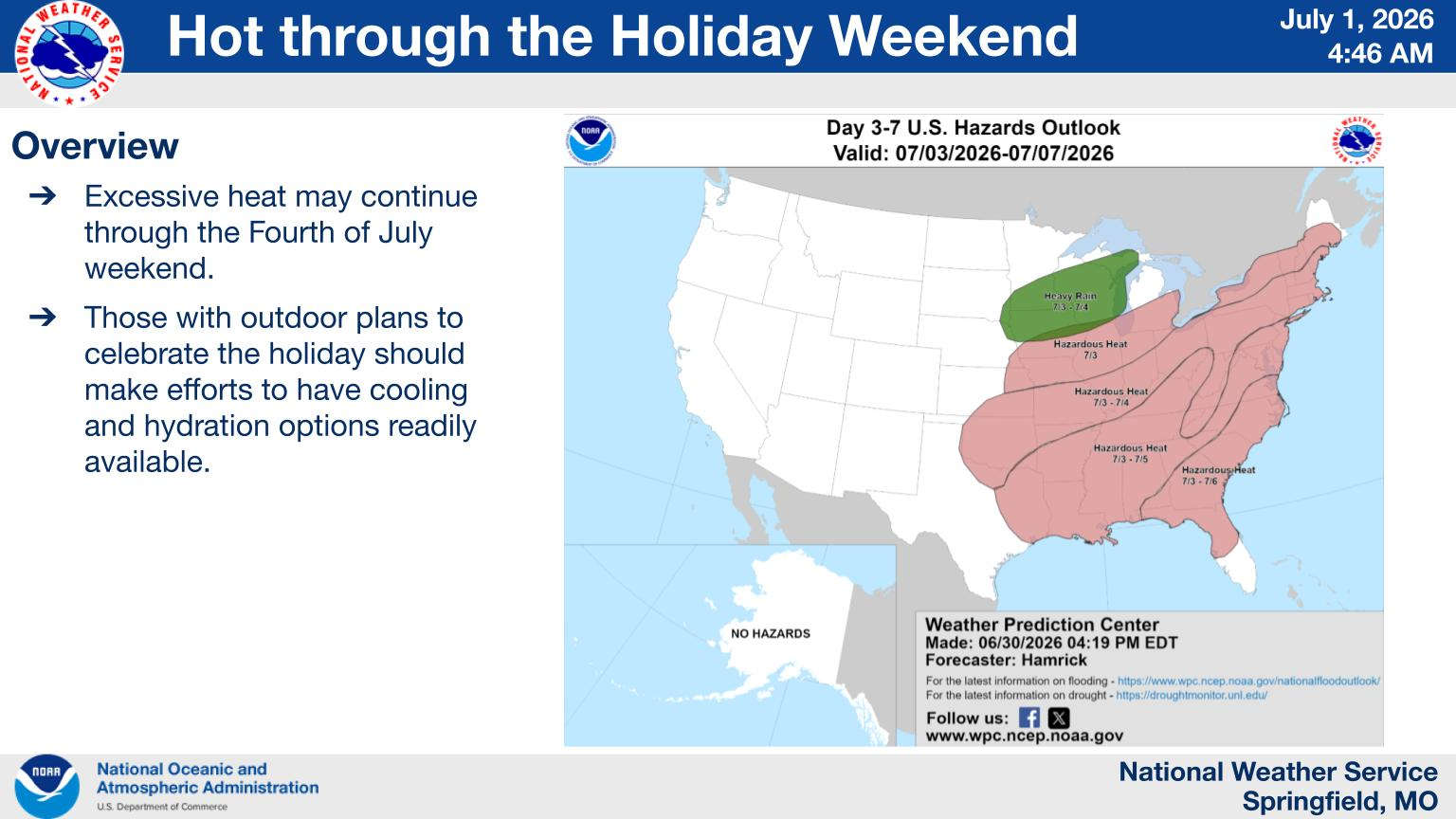 Heatwave Continue Though Pop-Up Showers Possible
 MSHP Works Traffic Crashes Involving Area Residents, Visitors
 When Will the New Highway 248 Bridge at Jenkins Open?
 Greatest Story Continues to be Told in Eureka Springs
 Fireburst to Once Again Light Up the Skies Around Table Rock Lake