

As a pair of storm systems approach the Lakes Region, many weather forecasters including the National Weather Service update their predictions of timing and amounts of precipitation to impact the region.
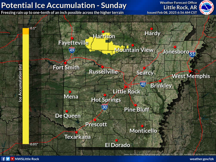
While most attention has been focused on Monday through Wednesday, the National Weather Service in Little Rock says some icing conditions could develop south of Harrison today in the Ozark Mountains with rain moving through. The areas impacted include parts of southeaster Boone County as well as portions of Madison, Newton, and Searcy Counties. Some localized hazardous driving conditions could develop today.
Here is a recap of the latest information on the two waves of storms expected this week:
Wave #1 Monday-Tuesday
It looks like the first system will bring primarily rain through the Lakes Region. Temperatures are expected at or above freezing for most of the time precipitation is falling though some light snow mixed in will be possible as precipitation begins Monday and ends Tuesday. Some minor ice accumulations are possible in areas between Branson and Springfield.
Wave #2 Wednesday
After a brief break Tuesday night, round two is expected to begin early Wednesday morning and will be a mixture of rain, freezing rain, and sleet. Some travel impacts and minor ice accumulations are expected. Precipitation is expected to end Wednesday night.
After the storm systems move through, the sky will clear and temperatures will gradually begin to warm for the rest of the week into next weekend.


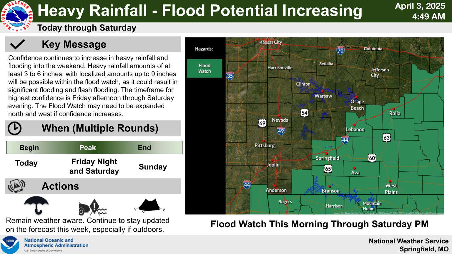
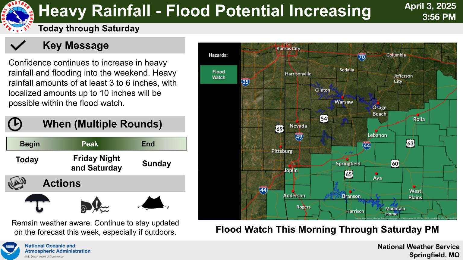 Heavy Rain, Severe Weather Update
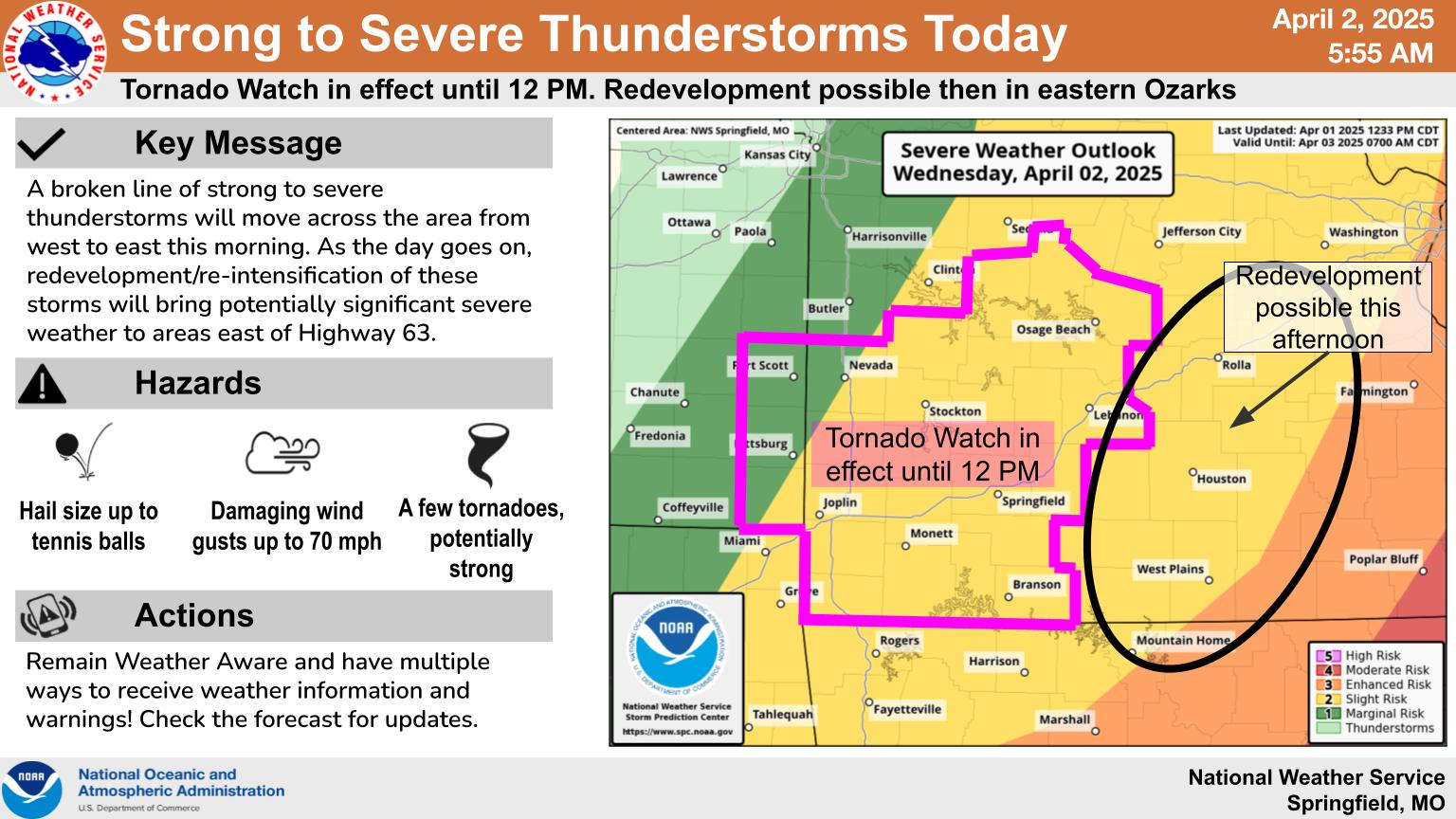
 Wednesday Storms, Thursday Rain
 Eureka Springs Police Officers Save Lives in Fire
 Active Weather for the Week, Weekend