

The up and down temperatures this week will see one more peak before landing on winter and bringing with it a chance of winter precipitation.
According to the National Weather Service a frontal boundary has moved back and forth this week which saw temperatures in the 70s one day, then in the 40s the next. The front moving north has given the Lakes Region a surge of warm air, but today will actually see temperatures drop as the front moves back south.
A final northern push will get temperatures to around 70 on Saturday before the system finally moves away for good bringing back winter temperatures.
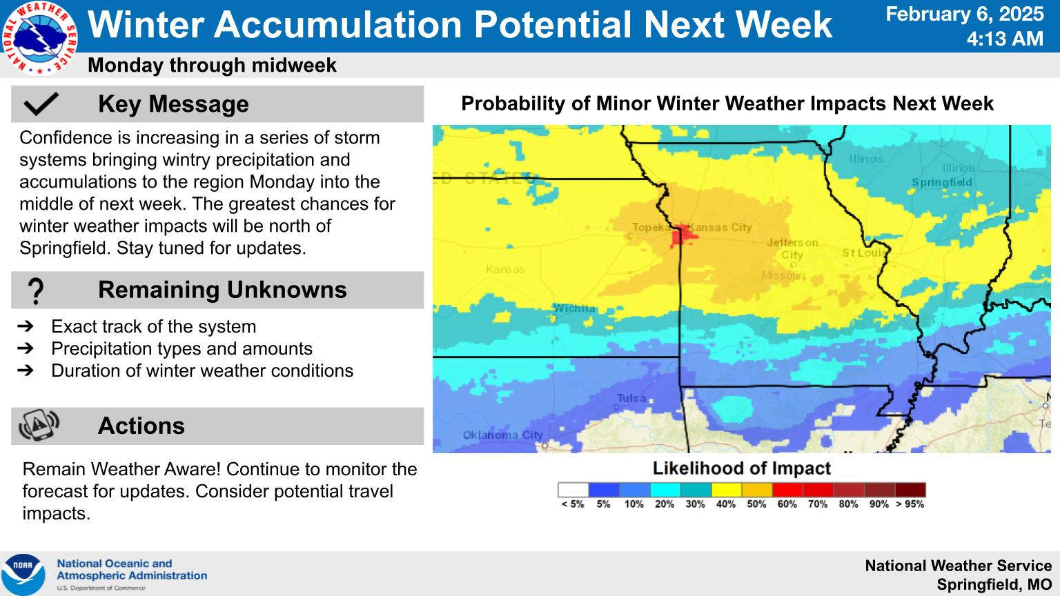
Forecasters are predicted to a series of systems early next week that could bring some winter precipitation into the picture Monday and Tuesday. While the highest chances for winter weather will be north of Springfield, some winter precipitation is expected to impact the Lakes Region.


 Active Weather for the Week, Weekend
 Sides Pleads Not Guilty in Taney County Case
 Toll road text scam growing across Missouri, nationwide